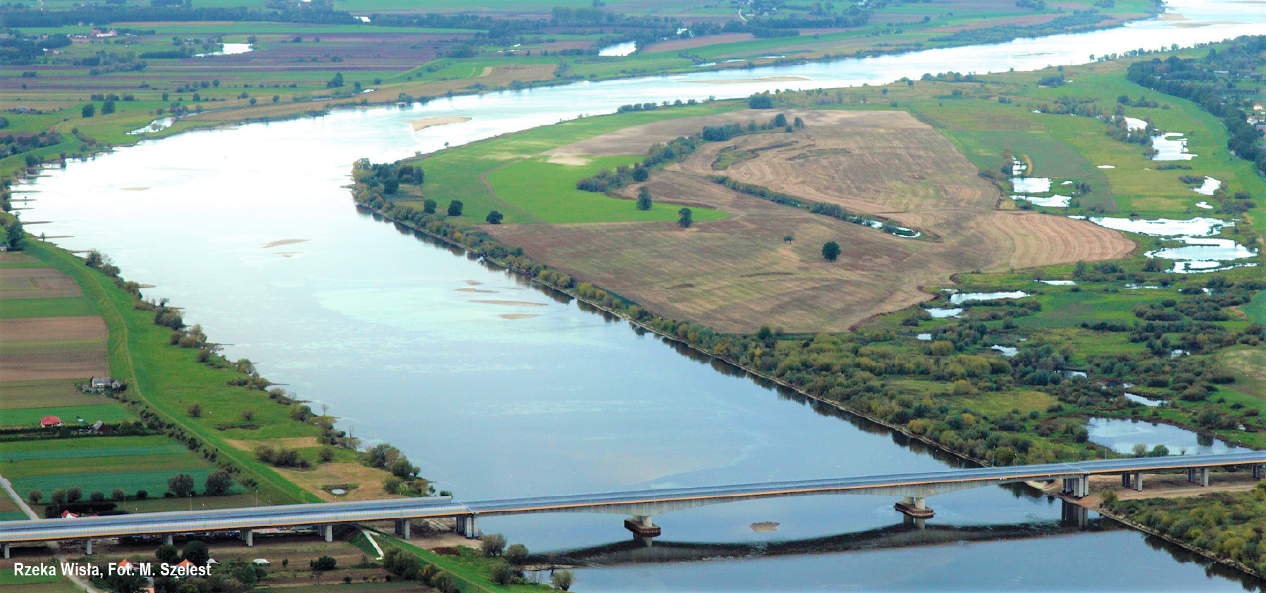
The Vistula is the longest Polish river and – the longest river flowing into the Baltic Sea. It is 1,047 km long and, its basin covers more than a half of the country and the river itself is often referred to as the Queen of Polish Rivers – also because of the huge role it played in the history of our country. The turbulent history of the Polish nation took place right on its banks, where centuries ago Poles founded cities, such as Cracow, Warsaw, Toruń, and Gdańsk.
The Vistula is divided into 3 main sections: upper, middle, and lower. This division was based upon the borders set during the partitions of Poland.
The upper section is around 270 km long and runs from the river’s sources on the slopes of Barania Góra mountain in Beskid Śląski range to the mouth of the San river. It does not have any particular economic or navigational significance due to poor regulation and too low water levels. It is, however, a route of major scenic and tourist value, including the cities of Oświęcim, Cracow, Tarnobrzeg, and Sandomierz.
The middle section is the longest – and truly unique on a European scale thanks to the untamed nature of the river. Sandy islands are a common occurrence, as this section of the Vistula is only regulated by floodbanks. The ever increasing number of canoers get to visit a number of historical tows, such as Janowiec, Kazimierz Dolny, Puławy, and Dęblin.
The lower section of the Vistula flows from Płock to the mouth of the river in Gdańsk – this section was regulated during the German occupation. It takes us along a dam and hydroelectric power station in Włocławek, and the largest artificial water reservoir in Poland – Włocławskie Lake – among other things. Further on, we can visit numerous castles built by the Teutonic Order – in Toruń, Świeć, Grudziądz, and Gniew. In the Żuławy region, the Vistula creates a delta, splitting into the Nogat, Szkarpawa, Wisła Martwa, and Wisła Śmiała. Currently, the main mouth of the Vistula to the Gdańsk Bay is a ditch built in 1895.
NAVIGATION INFORMATION
Depth. From the mouth of the Brda (771.4 km) to Tczew (910 km), the Vistula is a class II navigable waterway with a guaranteed transit depth of 1.4 m. From this point – all the way to its mouth (941.3 km) – it is a class III waterway with a guaranteed depth of 1.6 m. You should be careful, though, as the Vistula carries significant amounts of aggregate which create washouts, often blocking the main route – the depth may drop even below 1 m.
Width. The width of the Vistula equals around 500 m. It is therefore necessary to carry binoculars on board in order to read the signs on the opposite bank. Keep a safe distance when sailing along the shore – from several dozen metres, up to even 200 m because of the often invisible or damaged regulatory spurs that reach far into the river.
Power lines, bridges, ferries. All power lines are located high (8+ metres at the highest navigable water), thus posing no navigational difficulties. The lowest bridge is located in Grudziądz with a clearance of over 5m at high water level, and almost 9 m at medium water level.
Marking. Shore markings along the lower section of the Vistula are compliant with the navigational regulations for inland waterways. It is crucial to follow them at low water levels.
Mooring. Apart from few marinas located on the banks of the Vistula, you should only choose sandy bays between spurs for mooring (do not forget to look out for fishing nets).
When approaching the shore, pay special attention to the rock fortifications along the entire length of the river, which pose a hazard to vessels.
In Toruń (IWW E40) – about 30 km from IWW E70 – from the Old Town side, at the 1.5 km section between the road and railway bridge, the wharf of the Vistula that belongs to the river panorama of Toruń was modernised. The quay has been adapted for mooring large passenger vessels and the reinforced terrace in the central part of this section is the perfect meeting and relaxation place on the Vistula River, particularly valued by tourists and residents. The AZS marina located at the Filadelfijski Boulevard (in the direct vicinity of the Old Town) was also rebuilt, allowing mooring for approximately 20 small vessels. In addition, mooring is possible in Grudziądz and Tczew.
Wind and current. Fast manoeuvres should be avoided due to the rather rapid current of the Vistula (approx. 3 km/h). The wind might also be an obstacle – by strong northern winds the waves reach even 1 m in height.
